Map
The Map section allows you to explore broadband coverage by searching an address or interacting directly with the map.
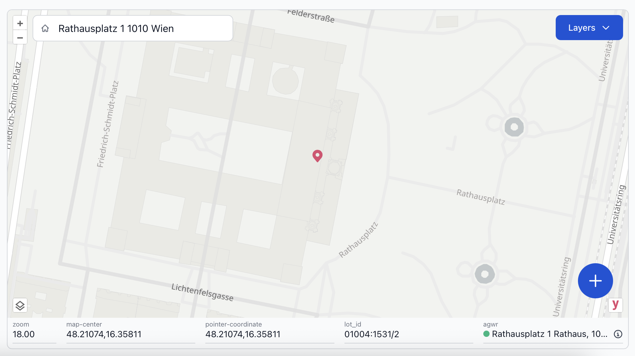
Searching an address or clicking anywhere on the map places a marker at that location. Relevant information is displayed below the map including:
zoom- the current zoom level of the mapmap-center- the coordinates for the center of the map displaypointer-coordinate- the coordinates of the placed markerlot_id- the cadastral lot ID that contains the markeragwr- the nearest matching address to the marker in the AGWR
Possible Actions with Info Below the Map
- Re-center the map by typing coordinates into
map-centerand pressing Enter . - Click the icon to quickly copy any data field.
The agwr address under the map represents the nearest building address in the AGWR to the marker's position.
The colored circle next to the AGWR address indicates whether the marker is located:
- within the same lot as the AGWR address
- in a different lot from the AGWR address
Hover over the agwr address to reveal detailed address information about the nearest matched AGWR address to the marker.
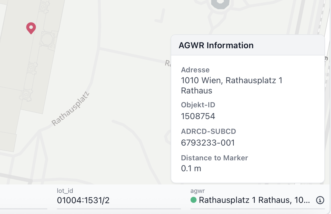
The agwr data includes:
Adresse- Closest building address to the markerObjekt-ID- Unique building object numberADRCD-SUBCD- Building address IDDistance to Marker- Distance in meters from the marker to the building in the AGWR
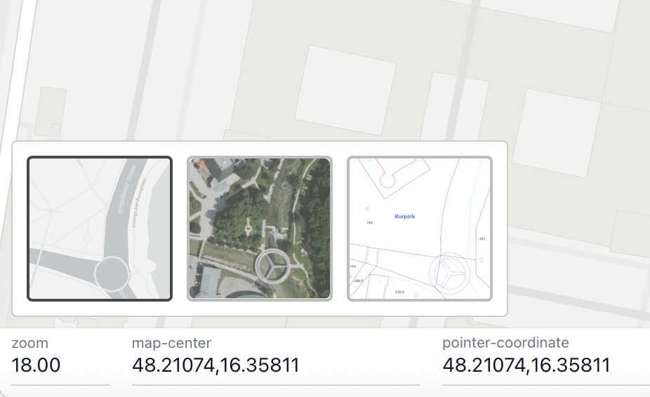
Use the icon (bottom left) to switch between basemap options: Open Street Maps, satellite view, and BEV Kataster (showing parcel boundaries).
Additional map layers such as access nodes, NTUs, building footprints, infrastructure elements, or coverage components can be toggled on/off under Layers.
Legend
| Map Markers | Types |
|---|---|
| Site | not suspended suspended |
| Access Node | planned construction operation |
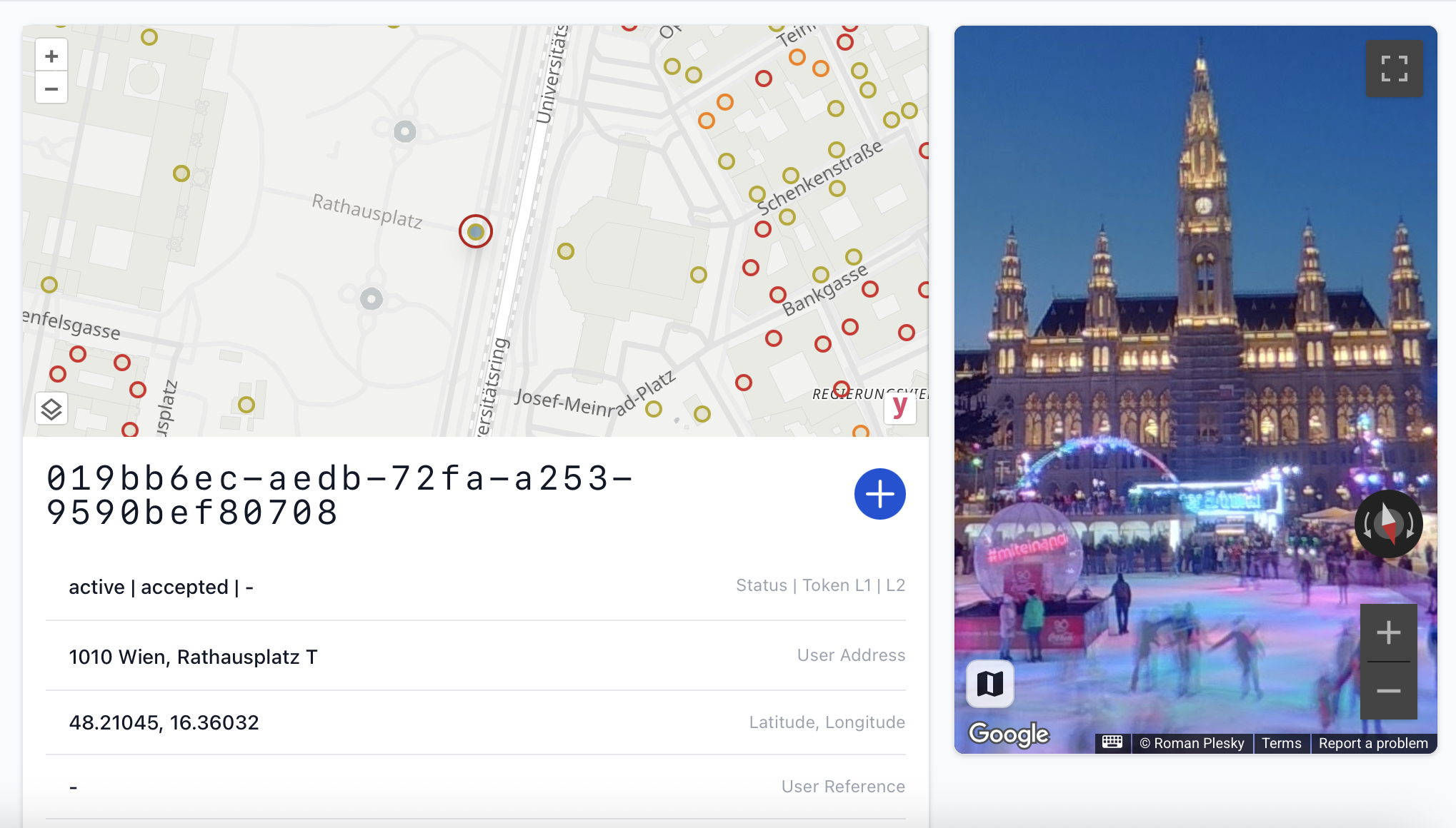
Google Street View
Google Street View can be accessed in the portal for sites with a fiber connection. Displaying the street-level map requires a Google API key.
API Key Creation
To integrate Google Street View into the portal, a valid Google Maps API key must be provided by the license holder. The key is used exclusively for the respective user or users within the same company.
An API key can be generated via the Google API Credentials page. On the page, select Create credentials > API Key.
We recommend applying the following optional restrictions to the key:
- Application restrictions:
Websites- Website restrictions: Add Website:
*.myfiber.at/*
- Website restrictions: Add Website:
- API restrictions: Select API:
Maps JavaScript API
Secure Submission of Key
After the API key has been created, please submit it securely using Infomaniak's kPaste.
- Paste the API key into the content text box.
- Set the message validity period to 1 week.
- Optionally, enable "Delete after the first reading".
Once the secure message link has been generated, please copy the link and send it via email to support@yio.at.